Images from the Collection of Barry Kinnaird
_____________________________________________________________
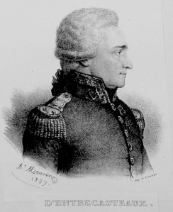
Bruny D’Entrecasteaux, Joseph-Antoine Raymond (1739–1793)
This article was published in Australian Dictionary of Biography, Volume 1, (MUP), 1966 – Link
Joseph-Antoine Raymond Bruny D’Entrecasteaux (1739-1793), admiral and navigator, was born at Aix, France, the son of a member of the Parlement of Provence, Jean Baptiste Bruny, and his wife, Dorothée de Lestang-Parade. After studying with Jesuit teachers at his home town, Bruny joined the navy at 15 to serve in the Seven Years’ war. In the years of peace he served in the Mediterranean and Indian Oceans where he developed an aptitude for hydrography which had appeared early in his career. As a result of his competence in this field, and his proven administrative ability, in 1786 he was made commander of the Indian Station of the French navy. While there he made his first significant exploratory voyage, sailing La Résolution to China, pioneering a new route via Sunda Strait and the Moluccas, which could be used in the monsoon.
When the term of his office expired Bruny was appointed governor of Ile de France and Ile Bourbon in the Indian Ocean. Services there, together with his reputation as a seaman and discoverer in the monsoon belt, brought him to the notice of Louis XVI, and when the National Assembly decided to send an expedition to search for the missing La Pérouse Bruny was chosen to lead it.
With two ships, La Recherche and L’Espérance under Huon de Kermadec, he left Brest on 28 September 1791 with orders to sail via the Cape of Good Hope, along the south coast of Australia from Cape Leeuwin to the east, and then into the Pacific. The object was twofold: to search for the missing navigator and to make scientific discoveries and surveys on the way, checking in particular the accuracy of the early Dutch and d’Apres charts of the South Indian and South Pacific Oceans. A number of learned men sailed with the expedition, including the hydrographic engineer Beautemps-Beaupré, the botanist La Billardière, the artist Piron, the astronomer l’abbé Bertrand, and the learned sailor de Rossel who later wrote the history of the voyage.
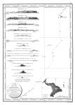
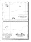
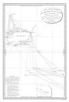
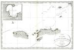
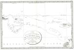
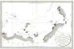
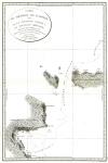
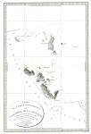
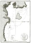
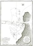
At the Cape of Good Hope Bruny learned from a letter that clothes and objects of French origin had been seen in the Admiralty Islands, so he decided to make straight for the Pacific. In southern latitudes he sighted and surveyed Amsterdam Island; he then sailed for Van Diemen’s Land, anchoring in Storm Bay on 23 April 1792. Here, while refreshing ships and crews, he made detailed surveys and charts of the southern coast, discovered that Adventure Bay was on an island (Bruny Island) and sailed through the channel (D’Entrecasteaux Channel) between it and the mainland. The expedition then made for New Caledonia, which was charted in the same thorough way, and between June and September he searched the seas to the north of New Guinea. He refitted at Amboina, and on 14 October sailed for the south-west coast of New Holland to carry out his instructions in those waters. The two ships sighted land near Cape Leeuwin on 5 December 1792 near St Allouarn Island, discovered by the French in 1772. The expedition then sailed eastward, exploring the coast of Nuyts Land to 129° 18′ E, near D’Entrecasteaux Reef. Running short of water, on 4 January 1793 Bruny sailed for Van Diemen’s Land, thus missing the coasts later discovered by George Bass and Matthew Flinders. He remained there from 21 January to 28 February, surveying and completing his charts and notes about the inhabitants. He sailed for New Zealand to investigate the coast, then north to scour the central Pacific for La Pérouse to the east of his previous course. On this leg of the voyage he surveyed Santa Cruz, which led him to within miles of the wrecked ships found later by Dumont d’Urville, and made many discoveries in the seas around the Solomon Islands and Bismarck Archipelago. Needing a refit Bruny made for the Dutch Islands, but died off the north-east of New Guinea on 20 July 1793. Since Kermadec had already died, the expedition was then led by d’Aribeau, but the latter, sympathetic to the French royalists, handed over his ships to the Dutch at Surabaya when he learned there that a republic had been proclaimed in France.
The records were taken to France with difficulty. A survey of the originals of these (for not all the documents were published in the official account) reveals the extent of useful scientific information collected in Australian Pacific waters by members of the expedition. They contain notes on vegetation, meteorology, chart work, the life, customs and language of native peoples as well as a variety of other topics; and these can still be searched with profit.
Select Bibliography
- E. P. E. de Rossel, Voyage de D’Entrecasteaux, vols 1-2 (Paris, 1808)
- L. R. Marchant, France and New Zealand, 1769-1846: A List of Naval Records in Paris(Perth, 1962).







You must be logged in to post a comment.